Posts tonen met het label Geography. Alle posts tonen

zaterdag 3 december 2016

Cultural Diversity - Global Collaboration

Inspired by friend, SMART Exemplary Educator & Google Certified Innovator Danesa Menge from California, USA and her class last year about cultural diversity, where they need a hand from my students with information about Anne Frank I was wanted to do more with this particular topic. With my global citizenship class I decided that they would create a SMART amp workspace for classes from abroad sharing information about our cultural diversity and cultural heritage. On the Global Collaboration G+ Group I made a call for teachers that would like to collaborate with my students. Within a day teachers from South-Korea, Czech Republic, Chile and several parts from the USA responded. Very powerful.
At the time that I'm creating this blog, classes from different parts of the world are adding content about their cultural diversity to the SMART amp workspace and are learning from others. To be continued ...

Seoul, South Korea

Oakdale, CA

donderdag 21 juli 2016

Pokémon GO

How I wished that I could create a game like Pokémon GO. Not for it's popularity or the amount of money that it'll gain, but mainly the idea. I want that for my students and I see a lot of possibilities. As a geography teacher I'm fond of getting outside with my students or have my students go out and explore their environment. With this new game (oh yes, I was sceptical at first, but now I'm a fan) kids and adults go outside, explore their environment with their phone to collect items at Pokéstops and/or catch Pokémons. This kind of gamification is addictive and something that I would like to add more to outdoor geography lessons. Still jotting down ideas and processing on this and hopefully after this summer I will have some outcome of this. To be continued ...

woensdag 30 maart 2016

Webinar: in real time collaboration

This Tuesday I was the presenter of a webinar where I would share how I set up a collaboration project within SMART amp™ in real time. Due to the fact that it was test week I was unable to do this during my lesson and use my students for this webinar. So I did prepare something else, but good enough to fit the topic of the day. SEE Emil Waldhauser from the Czech Republic was kind enough to help me out with the new setup of my webinar. We were going to show how to set up a collaboration in real time.

The topic of this webinar is not new to me, because I've done a few at SEE summits, Google summits, at the advanced teacher academy in Surinam and am doing one next weekend at the university of Madrid. One could say I'm an expert, I think I just have a lot of experience with setting up (global) collaboration projects with the use of SMART amp™ and am more than happy to share that experience.

I use SMART amp™ in my SMART Collaborative Classroom and have recently it been using in my exams class with the geographical topic of the building of a new landing strip of the airport Schiphol. They needed to emphasize with the different point of views from third parties involved. The needed to think of pros and cons about this idea. This is quite easy for me as a geograph teacher, because loads of things that happen around us could be used in a way like this: refugees from Syria, environmental issues, asylums for refugees in our own town, drilling for oil in the Arctic etc. Especially political issues matter and an easy to transform into good lessons.

When working together make sure that you as a teacher remark the students with the basic principle that collaborating with each other is based on equality. Especially when collaborating with students from other countries make sure that students have these two things in mind: reciprocity & equivalence. 

There are a few ways on how to set up in real time a collaboration project with SMART amp™ in your classroom.
- For students within gafe domain (in your class or between classes within same gafe domain).
- With externals
1. Students and/or teachers from other gafe domain
2. Students and/or teachers without gafe domain, yet added to yours by adding them to your gafe domain.

Make sure that technology works for you, since you're using education technology in your collaboration project. So all(!) students or classes need to have  gafe accounts and access to SMART amp™. Students need to have access to devices and either a wifi or WLAN connection. Best to create the workspace in advance and clarify the goals for your students.

Then on top of all preparations is the pedagogy. This is really important. Whether you have this big idea or topic that you want students to work on and collaborate with each other you could do two things:
- Either let students decide which way the learning is going. They will have wild ideas and they just go as they please. This wil have some pros and cons of course:
Pro: learning how to work within amp and explore it's possibilities.
Con: does it aim for your goals?
- Or prepare good questions ahead and share with students what the goals are that you as a teacher are aiming for with the class. Clarify all that's needed to have a successful collaboration project.

The topic that I used for the webinar was: cultural heritage. 

During this collaboration lesson I would let students take pictures of things and have them describe what cultural things they are proud of and ar willing to share with others - ie. the world.

Main goals:
1. From a student perspective you as a teacher are able to determine what they think is their cultural heritage,
2. Learning from others about their cultural heritage from their point of view will (hopefully) bring more understanding amongst each other instead bigotry behaviour,
3. When showing and sharing with others I believe that it will definitely bring the quality of the shared work to a higher level, due to the fact that others instead of just the teacher are watching as well.

Good luck with your project!


maandag 16 november 2015

KNAGdag 2015

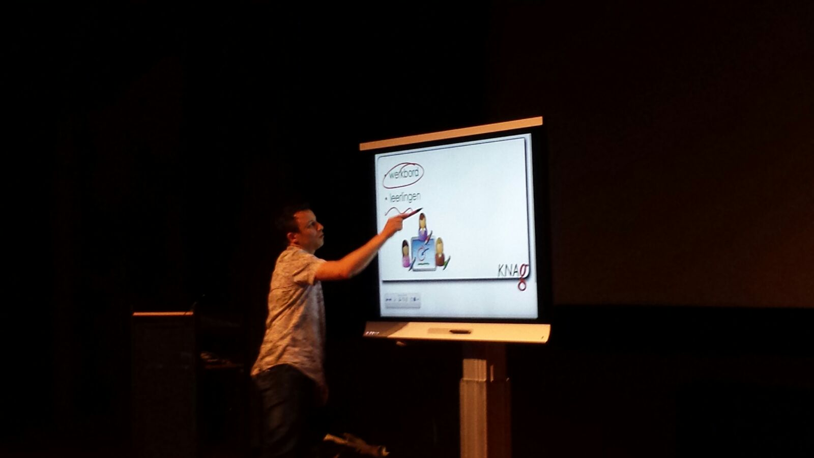
Afgelopen vrijdag de 13e m'n interactieve presentatie gedaan over de didactische meerwaarde en inzet van het digitale schoolbord bij het aardrijkskundeonderwijs op de KNAGdag, welke als thema 'Toekomst' had. De onderwijsdag voor leraren aardrijkskunde werd gehouden in theater Cinemec in Ede. Samen met twee collega's aardrijkskunde van het Ashram College ben ik afgereisd naar Ede om m'n presentatie te houden. Er waren ruim 800 aardrijkundedocenten, waaronder een aantal oude bekenden en zelfs m'n eigen oud-leraar van de lerarenopleiding: Jaap van Eekeren.

Aan het werkbord: De SMART kapp iQ.

Vanwege de grote hoeveelheid aanmeldingen, mocht ik in de grote zaal m'n ding doen. Ik had zelf gezorgd via Techdata dat er een SMART Board 6065 (kapp iQ) in de zaal aanwezig was, want als ik wilde laten zien wat ik didactisch doe met dat digitale schoolbord in mijn SMART Collaborative Classroom, dan moet ik natuurlijk wel de touchgevoeligheid van het scherm kunnen laten zien. M'n focus lag op drie zaken. Het digitale schoolbord als:

  1. Teachershub, waar ik allerlei content van de leerlingen kan verzamelen en laten zien aan de klas. Niet per sé digibord software voor nodig, omdat een verzameling van tweets of Instagram posts ook met een beamer kan, maar zodra SMART Notebook LAB aan bod kwam werd het interessanter en leuker. Leerlingen kunnen hun bijdrage (tekst en/of afbeeldingen) dan in de SMART Notebookles plaatsen. Echt gaaf. De creativiteit van de docent bepaalt ook hier weer hoe dat didactisch weg te zetten ...
  2. Een SMART Board (of ander gerenommeerd merk digibord) is in principe een werkbord. Voor leerlingen en veel minder bedoelt als presentatiescherm. (Wat dus wel vaak de praktijk is). Dat kan dus m.b.v. de aanraakgevoeligheid - de beperking is dat niet de gehele klas dat tegelijkertijd kan doen of in een BYOD omgeving kan elke smartphone, tablet of laptop een bijdrage leveren.
  3. Omdat het een aardrijkskundeconferentie is heb ik ook een pleidooi gehouden voor Global Collaboration en laten zien hoe ik dat in mijn lessen doe. Enthousiasme. Leuk.

Na wat over de onderwijsmarkt te hebben gelopen (en bij de BuiteNLand-stand een Google Cardboard gescoord en wist je dat Greenpeace heel leuk en gratis lesmateriaal aanbiedt?) heb ik zelf ook nog een workshop gevolgd over het gebruik van Lego in de aardrijkskundeles door Falco Zwinkels. En dat was superleuk! Werken met Lego is een superleuke manier om leerlingen te leren goed te kijken om vervolgens zelf bijvoorbeeld een geografisch begrip of proces uit te beelden m.b.v. Lego blokjes. Ga ik ook een keer oefenen.

Deze KNAGdag was zeer geslaagd en met een koffer vol nieuwe ideeën en contacten ging ik weer naar huis.


SMART Exchange: database van digibordlessen voor het SMART Board.
Google+ community voor Global Collaboration.
Lego Education over het gebruik van Lego in het onderwijs.

zaterdag 31 oktober 2015

TomTom

For the past 15+ years one of the first assignments my students need to do when they enter my classroom in the 7th grade, freshly from primary school, is to draw a map of their route from home to school. This is for understanding and reading maps whilst having a proper look around with a pair of geographical glasses. ;) They need to add the scale, a title, a compass (at least the arrow that points to the north) and the legend of their map.
And since a couple of years my students seem to be less engaged or at least that's what their work looks like and that doesn't make me happy. So one of my colleagues helped me out and she asked why I didn't use the iPad instead (since 7th graders start with iPads this year) and let them create a TomTom alike stop-motion video from their route from home to school or vise versa. Great idea! With great results. And after they've done the video they had to watch their video and create a map with al the landmarks that is visible in their video. Also great results.

Most of my students used the Lego Movie Maker stop-motion app, which is very good and free!

Two awesome videos created by my students:


zondag 3 mei 2015

Netherlands Google Apps for Education Summit


One of the cool things is to present at education summits in order to share best practices and share ideas with others attending the summit. As you could've read in another blog post I applied to do a session about SMART amp at the Netherlands Google Apps for Education Summit this weekend and that went very well. I did prepare my presentation in English, but due to the fact that only Dutch people attended I did it in Dutch anyway. I handed out some leaflets with more information and every attendant received a SMART Board pointer. The attendants needed to log in to SMART amp with pre-created accounts by me and needed to work together in a workspace where I published a assessment as well. The teacher that gained the least score for the assessment received a SMART amp t-shirt, due to the fact that all the other teachers scored 100% on the assessment.


On Sunday we we started with a real good Keynote by Dan Leighton (Director of Technology, Grammar School of Leeds) about effective strategies in the classroom to gain more engaged students and higher grades. Top two things concerning was he impact of good feedback (formative evaluation) to students and and meta-cognition (self reported grades). I need to process on this ...

The first session was getting more out of the admin console with Google Admin within your domain. I've learned a lot of things and Sarah Woods really took my understanding of working within the admin console to the next level. I'm very happy that I learned a lot today already. Next was the session of Warren Apel with easy to use tips and tricks on how to create engaging activities with Google Maps in your classroom. This was really mind bowing and I've shared a few interesting links in this blog and will create a new one about the cool things you can do with My Maps in Google Maps.

This Google Apps for Education Summit was awesome and I do have a lot to take with me and need to process on!!!


Cool tips and tricks:

Realtime Board: online whiteboard in your browser.
Thematic Mapping: create kml-files for Google Earth.
Open Signal: compare phone signal coverage in the entire world!
GeoGuessr: Explore the world in a real fun and challenging way.
Time Machine with Google Street View.
Google Treks: help out Google Street View in places where cars can't get to.

Cool fun fact that I learned: did you know that when you need to type something unreadable when signing in somewhere, the so called captcha thing, is actually really cool and whenever you use it you' helping out humanity by helping to save our own ancient cultures? These hardly readable things we need to re-type are actually pieces of text from ancient written text and we ar actually helping out to translate them. And the blurry pictures of street numbers we need to re-write are actually from pictures Google Street View took and we help out by mapping the world better. Ain't that just awesome?